Privacy statement: Your privacy is very important to Us. Our company promises not to disclose your personal information to any external company with out your explicit permission.
Select Language
| measurement accuracy | |
| Measuring range | |
| Contacter Maintenant |
Modèle: XR3000C
marque: Rxiry
Période De Garantie: 3 années
Personnalisation Du Support: OEM, ODM
| Unités de vente: | Piece/Pieces |
|---|
Incoterm: FOB,CFR,CIF,EXW
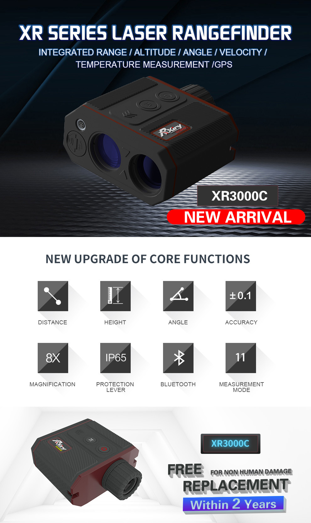
Rxiry Laser Range Finder XR3000C
Rxiry XR Series Laser Rangefinder , Un ultime instruments d'arpentage pour les professionnels. Dans une conception ergonomique , robuste et facile à maintenir, il y a un bouton de feu, également appelé bouton de mesure et bouton de mode. Facile à utiliser.
Deuxièmement, passons en revue les spécifications clés
Il offre 8 x optiques supérieures qui améliorent votre champ, la résolution de 0,01 et la précision de la plage de 0,1 m, la plage maximale peut être de 6100 m.
Capacité avec AZ + Inc + SD Calculs embarquées: calcule la distance horizontale (HD) + distance verticale (VD) + hauteur (HT) + ligne manquante 3D (ML)
Si votre mesure était en question, vous pouvez basculer sur le mode proche et éloigné pour vous assurer que le capteur laser ignore les obstructions indésirables qui sont devant ou derrière la cible souhaitée.
Pour plus de stabilité, utilisez Th4 1/4 '' - 20 thread pour le montage du télémètre sur un personnel ou un monopode.
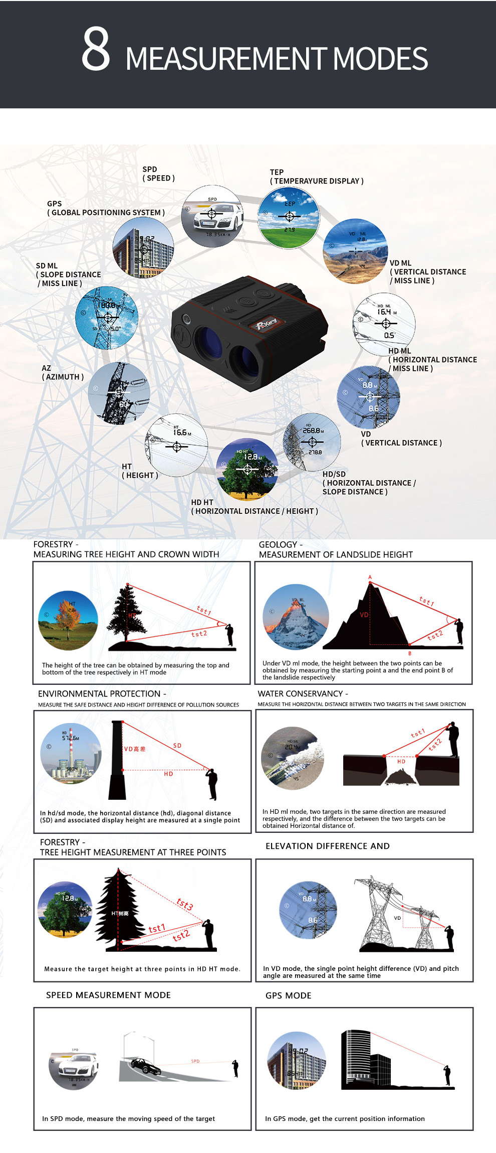
| SD Slope Distance |
Straight line distance between the rangefinder and the target. |
| VD Vertical Distance |
The distance between the target and the perpendicular to the path of the horizontal distance. |
| HD Horizontal Distance |
The level distance between the rangefinder and the plane of the target |
| INC Inclination |
The angle of inclination between the rangefinder at level and the target. |
| AZ Azimuth |
The magnetic heading to the target referenced to magnetic North |
| HT Height |
Three-step height routine. The final calculation represents the vertical distance between the points on the target represented by ANG1 and ANG2. |
| ML Missing Line |
Two-step Missing Line Routine finds the connecting vector (or missing line) between two points. The final calculation shows the SD, VD, HD, and INC associated with the missing line |
| SPD Speed |
Measure the speed of moving target |
| GPS | Collect the rangefinder GPS position information |


The file is encrypted. Please fill in the following information to continue accessing it


Privacy statement: Your privacy is very important to Us. Our company promises not to disclose your personal information to any external company with out your explicit permission.

Fill in more information so that we can get in touch with you faster
Privacy statement: Your privacy is very important to Us. Our company promises not to disclose your personal information to any external company with out your explicit permission.